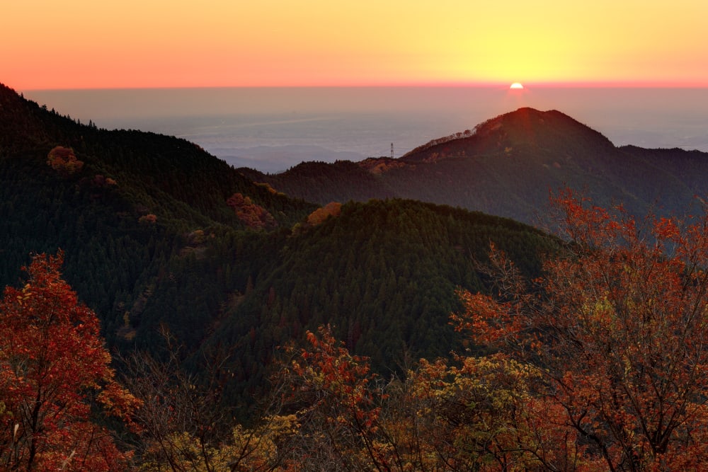
Mt. Mitake (Mount Mitake) is a forested mountain in western Tokyo, popular for its historic Musashi Mitake Shrine, sacred cedar trees and moss-covered Rock Garden. At approximately 929 metres above sea level, it offers a very different experience from central Tokyo: mountain villages, wooded paths, streams and short-to-moderate hikes. It is a rewarding day trip for visitors who want nature without travelling to a distant alpine region.
The mountain is approachable by train, bus and cable car, but the trails are not all equally easy. The shrine involves uphill walking and steps, while the Rock Garden has uneven and sometimes slippery surfaces. This updated guide explains transport, cable-car fares as of 1 October 2026, suggested routes, safety and how to choose a hike suited to your group.
Key Takeaways
Mt. Mitake Quick Facts
- Location: Ome City, western Tokyo, Japan.
- Elevation: approximately 929 metres.
- Main attractions: Musashi Mitake Shrine, sacred cedar trees, Rock Garden, forest trails and mountain viewpoints.
- Nearest JR station: Mitake Station on the JR Ome Line.
- Cable car: Takimoto Station to Mitakesan Station, around six minutes.
- Hiking: a short shrine visit is easier than a full Rock Garden loop; route choice and weather matter.
The Japan National Tourism Organization’s Mt. Mitake guide describes a typical six-to-eight-kilometre hike taking roughly three to four hours. Treat this as a general example rather than a promise for every route, fitness level or weather condition.
How to Get to Mt. Mitake from Tokyo
Step 1: Take the Train to JR Mitake Station
From Shinjuku, travel west using JR services toward Ome and transfer to the JR Ome Line for Mitake Station when necessary. Some services require more than one change, so check a current route planner before leaving. The journey is often described as about 90 minutes from central Tokyo, but actual travel time depends on your departure station, train connections and service pattern.
If you are planning several outdoor day trips, compare Mt. Mitake with Mt. Takao, another popular hiking destination in western Tokyo. Mt. Takao has a different transport route, trail network and atmosphere, so do not assume their access arrangements are interchangeable.
Step 2: Bus from Mitake Station to Cable-shita
From JR Mitake Station, take the local bus toward Cable-shita, near the lower cable-car terminal. The bus ride is usually around ten minutes. Check the bus timetable and make sure you have sufficient time for the return journey, particularly outside peak hiking hours. Walking all the way from the railway station adds significant distance and climbing to the day.
Step 3: Cable Car from Takimoto to Mitakesan
The Mitake Tozan Railway cable car connects Takimoto Station with Mitakesan Station in approximately six minutes. According to the operator’s official timetable and fare page, fares were revised on 1 October 2026: adult tickets cost ¥700 one way or ¥1,400 return; children’s tickets cost ¥350 one way or ¥700 return. A return ticket is valid for one round trip within two days, subject to the operator’s conditions.
These prices cover the cable car, not the JR train or connecting bus. The operator’s English visitor information provides additional guidance on facilities and transport. Recheck fares, operating times and service notices immediately before visiting because maintenance or severe weather can affect operations.
Step 4: Walk to the Shrine and Trailheads
From Mitakesan Station, continue on foot toward the mountain settlement and Musashi Mitake Shrine. The cable car saves much of the ascent but does not deliver visitors directly to the shrine steps or Rock Garden. Allow additional time for the uphill approach, breaks and the return to the cable-car station.
What to See and Do on Mt. Mitake
Musashi Mitake Shrine
Musashi Mitake Shrine is the spiritual centre of the mountain. Its origins are traditionally traced to antiquity, although very early foundation dates should be understood as part of shrine tradition rather than independently verified modern chronology. The shrine’s buildings, stairways and surrounding forest make it a rewarding destination even for visitors who do not plan a long hike.
The shrine has strong associations with protective mountain spirits and is known for welcoming visitors with dogs. Pet owners should still check current transport and shrine rules and keep animals under control. Take time to observe local etiquette: avoid blocking worshippers, respect restricted areas and follow any photography notices.
Sacred Cedar Trees and Mountain Village
Large cedar trees are a distinctive feature of the route. Some have traditional associations with safe childbirth or good fortune in relationships. These are cultural beliefs, not medical claims. The walk through the settlement also offers small shops and accommodation houses, although opening hours vary and should not be assumed.
Visitors interested in mountain shrines elsewhere in Japan might also enjoy the Takaosan Yakuoin Temple area on Mt. Takao, but the history and religious traditions of the two sites are distinct.
Mitake Rock Garden
The Rock Garden is one of the area’s best-known nature walks. A stream runs between moss-covered rocks and forested slopes, creating a cooler environment in warmer months. The official Tokyo tourism guide describes a scenic section of approximately 1.2 kilometres along the stream, within the Chichibu-Tama-Kai National Park area.
Spring and early summer can be especially attractive for green moss, but conditions depend on rainfall and weather. Expect roots, stones, steps and potentially slippery surfaces. The Rock Garden should not be treated as a level urban park path. Stay on designated trails and avoid entering the stream or stepping on delicate moss.
Waterfalls and Forest Trails
Some Rock Garden routes connect with waterfall viewpoints and longer forest paths. Check the latest trail notices before choosing a loop, because storm damage, fallen trees and maintenance can temporarily close individual sections. Do not follow an old map through a closure. The Mitake Visitor Center is a useful place to ask about route conditions and suitable alternatives.
Choosing the Right Hiking Route
Option 1: Cable Car and Shrine Visit
For a shorter outing, take the cable car, walk through the mountain village, visit Musashi Mitake Shrine and return by the same route. This option reduces the distance and elevation gain, but the approach still involves uphill sections and stairs. It is a good choice for visitors primarily interested in scenery and culture rather than a demanding hike.
Option 2: Shrine and Rock Garden Loop
Allow a substantial part of the day for the shrine and Rock Garden. Depending on the exact loop, the walking distance and difficulty are greater than the short shrine visit. Carry water and food, start early enough to finish in daylight, and be prepared to turn back if the weather deteriorates.
Option 3: Longer Mountain Hike
Experienced hikers may combine Mt. Mitake with longer ridgeline routes. These should be planned using current official maps, not only a short destination overview. Steeper trails, exposed sections and additional elevation gain can make them unsuitable for casual visitors. If you want a different full-day nature experience, compare the landscapes around Okutama and Lake Okutama.
When Is the Best Time to Visit?
Spring and Early Summer
Fresh foliage and moss make the forest especially appealing. May and June are frequently recommended for the Rock Garden, but rain can make rocky sections slippery. Carry a waterproof layer and do not assume warm city temperatures mean the mountain will feel equally warm.
Autumn
Autumn can bring colourful foliage and pleasant walking temperatures. Popular weekends may be busier, and daylight becomes shorter. Check the last cable-car and bus departures before beginning a late-afternoon hike.
Winter
Cold temperatures, frost, snow or ice can make trails hazardous. A shrine visit may still be possible in suitable conditions, but visitors without winter hiking experience should avoid icy paths and follow official closures. Cable-car operation does not guarantee every hiking route is safe.
Hiking Safety and Visitor Facilities
What to Bring
Wear shoes with good grip, carry water, a charged phone, a warm or waterproof layer, and a small first-aid kit. A paper or offline map is useful because mobile reception can vary. Bring cash or a payment method accepted by local shops and transport providers.
Trail Etiquette
Stay on marked paths, take rubbish home and avoid disturbing wildlife. Give way where trails narrow and respect other hikers. Keep dogs leashed where required. If a path is closed, choose a permitted alternative rather than bypassing barriers.
Mitake Visitor Center
The visitor centre provides local nature and trail information. The official Tokyo guide lists typical opening hours as 9:00–16:30, with Monday closures and holiday exceptions; verify the latest hours before relying on a visit. Staff or posted notices can help you assess whether the Rock Garden and other trails are suitable that day.
Other Nature Day Trips from Tokyo
If you are comparing hikes, Mt. Takao has a well-established network of trails, while Takao Monkey Park and Wild Plant Garden offers a different type of stop. Mt. Tsukuba and Mt. Nokogiri are other mountain excursions, but each requires its own transport planning.
For less strenuous green space within the wider Tokyo area, consider Todoroki Valley, Inokashira Park or Shinjuku Gyoen; verify access restrictions and seasonal rules. For more ambitious outdoor travel, explore Oze Marsh or the Lake Kawaguchi area, noting that these are not quick add-ons to a Mt. Mitake hike.
Frequently Asked Questions
Is Mt. Mitake suitable for beginners?
The cable-car-and-shrine route can suit many beginners who are comfortable with uphill walking and steps. The Rock Garden and longer routes require more care, especially in wet conditions.
How much is the Mt. Mitake cable car in 2026?
As of the 1 October 2026 fare revision, the official adult fare is ¥700 one way or ¥1,400 return, with children’s fares of ¥350 and ¥700 respectively.
Can I hike Mt. Mitake without using the cable car?
Yes, there are walking approaches, but they add significant climbing and time. Check official trail conditions and plan your return transport before choosing this option.
How long should I spend on Mt. Mitake?
Allow at least several hours for the cable car and shrine. A Rock Garden hike is better planned as a half-day or longer outing, with additional time for transport, food and breaks.
Is the Rock Garden always open?
No trail should be assumed open in all weather. Check current visitor-centre notices for closures, fallen trees and route conditions before setting out.
Official Sources
For route planning, consult JNTO’s Mt. Mitake overview, the Mitake Tozan Railway timetable and fares and the Tokyo tourism guide to Mitake Visitor Center. Recheck current operating conditions shortly before departure.
Address And Maps Location:
Ome-shi, Tokyo-to
Find Location And Direction On Google Maps
Subscribe, follow travelbloggerindonesia.com